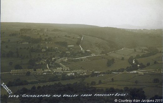
Old Postcard of Grindleford - Derwent Valley from Froggatt Edge
This image shows a Grindleford which differs significantly from the present day. Most notable is the junction of Sir William Hill with Road, with the Main Road, showing the group of cottages which once stood on the south-west corner (on the left, in this photograph). They have been demolished for many years, and the road junction has been widened. The roads are readily identifiable - that in the centre foreground is the Main Road from Calver on the left, towards Sheffield on the right; and the road running vertically is Sir William Hill Road, the old road to Eyam. The road running at an angle to both is to Hathersage. You can also see the arch of the Main Road where it crosses over the river. A building called “The Tower” can be seen, in the top left hand quadrant of the image, in what is known as Bank Top Lane. This was demolished in the 1960s as it had become unsafe. It is also possible, in the enlarged version (129K), to see the old Smithy, opposite Toll Bar Cottage (to the right of the Bridge). (Information provided by Alan Jacques/Rosemary Lockie)
Image contributed by Alan Jacques on 15th February 2011.
|
||
