“Arise, Sir William Hill”
By Alan Jacques, © Copyright 2000
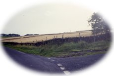
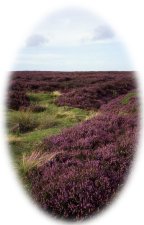
In the Black Mountains, south of Hay on Wye, is Lord Hereford's Knob and near Cranley in Surrey is Lord Justice James Seat. North of the Border, one of the peaks of remote An Teallach is called Lord Berkeley's Seat. The Lake District has Sergeant's Crag, John Bells Banner and Arthur's Pike, while above Ullswater is a hill simply called The Knight. In the Peak we also have some noble sounding hills; Lord's Seat on Rushup Edge; Lordship Hill north east of the Snake Pass near Hurst Reservoir; Alderman's Hill is above Dovestones Reservoirl, while near Harpur Hill there is Countess Cliff. Other hills with personal names include Ringing Roger, Margery Hill, James Thorn on Bleaklow, Dick Hill above Dovestones Reservoir and Gilbert Hill at Langsett. There are two hills called after Anthony, one near Elton with another south of Buxton, Oliver Hill is near Flash, Charles Head at Kettleshulme, Andrew's Knob near Pott Shrigley and Johnson's Knoll near Biggin. Not forgetting the Heights of Abraham at Matlock Bath, where there is also a Jacob's Ladder as there is in Dovedale. But no other hill, height, tor, mount or fell has the titular prefix of Sir. Just who was Sir William and why was he so important to have this unique claim to fame? Not only is there a hill named after him, but also there is also a road and a hotel. There is some controversy over just which Sir William the hill was named after, and there are several contenders. M.J.B. Baddeley, in his 1899 guide to the Peak District, wrote that the hill might have been named after "Sir William Peveril, the natural son of William the Conqueror." Peveril was an important man, but was he ever knighted? As bailiff of the royal manors in north Derbyshire, the Royal Forest of the Peak was under his control, so such a powerful man could have left some lasting impression on the place-names of the area. The influence of Chatsworth is felt in almost every aspect of Peak history, and any one of the four Sir William Cavendish's should be considered. The 1st Sir William Cavendish (1505-1557) was the husband of Bess of Hardwick. The 1st Earl of Devonshire (1552-1625) was also Sir William, and was knighted by Henry VIII for his role in the dissolution of the monasteries. The 2nd Earl (1590 -1628) was dubbed Sir William while in his late teens and became a close friend of the philosopher Thomas Hobbes. As a child, the 3rd Earl (1617 -1684) was made Knight of the Bath at the coronation of Charles I, to become the fourth Sir William Cavendish. With such a family pedigree, would the naming of a hill in the wilds of north Derbyshire be worthy of note to the Cavendish's? In 1616, Mary, Countess of Pembroke, gave the Parish of Eyam to her relatives, the Savilles of Beeley. Sir William Saville, the 2nd Marquis of Halifax, a grandson of the sixth Earl of Shrewsbury, became Lord of the Manor of Eyam. During the Civil War, Sir William Saville commanded Royalist forces, which occupied Leeds and Wakefield. After an attack on Bradford had been repulsed, the Parliamentarians under Fairfax forced him back to Leeds. Sir William became Governor of Sheffield and was killed near York in 1644. Sir William Bagshaw, 1771-1832, medic, country gentleman and patron of the arts, was a local knight of note who was also appointed High Sheriff for Derbyshire in 1805. He had estates at Oakes Park, now part of the City of Sheffield, Goosehill Hall at Castleton and Wormhill Hall near Tideswell. The hill is centrally placed between these properties and he would certainly have traveled over it, being the shortest route between Sheffield and Tideswell. The hill was known as Sir William at least as far back as 1692, when an entry in the Eyam Parish Registers records that Elizabeth Trout died on the 4th of February, "upon the moor near unto Sir William, coming from Tideswell market in the snow." On this evidence we will have to discount Sir William Bagshawe, who was not born until 1771. The road over Sir William is certainly an ancient one. It was formerly a packhorse route, part of the complex system of saltways that crossed the Peak between Cheshire, South Yorkshire and the east coast. The narrow, paved footpath from the bridge at Grindleford leading up to Sir William is known as Scots Close, reputedly after one of the jaggers, a man in charge of a train of packhorses. This same path continues straight up the hill, away from the road, with sections of it known locally as Haslin Slack and Stoney Bank. The route subsequently became part of the Sheffield to Buxton Turnpike of 1758. The steep climb of almost 1,000 feet in two miles from Grindleford Bridge to the summit must have been a severe challenge to early travelers. This resulted in the abandonment in 1795 of this very difficult, exposed road in favour of a lower route through Eyam and Foolow. Sir William Hill is a fascinating place to walk over and several good footpaths cross it. There are excellent routes over Eyam Moor and Gotherage down to Stoke Ford in Bretton Clough, all of which reward the walker with wonderful panoramic views taking in Froggatt Edge, Burbage, Win Hill, Mam Tor, Kinder Scout and Bleaklow. On the north eastern flank of the hill is Wet Withins, a stone circle consisting of 12 standing stones within an earth bank about 10 feet (3m) across, believed to be from the Bronze Age. The moor also has many Bronze Age barrows and the remnants of ancient field systems. The chimney of Ladywash Mine, where lead was mined and which was worked until quite recently for the extraction of fluorspar marks the influence of modern man. Nearby was New Engine Mine, which had the deepest shaft of any lead mine in the Peak District at 1,092 feet (333m). There was also a tall chimney here, formerly another notable landmark on Sir William Hill, until an unfortunate incident in the early 1970s, when an insensitive landowner demolished it. Just off the road that leads down to Eyam can be found Mompesson's Well, where supplies were left for the beleaguered residents of the plague village of Eyam in exchange for money that was placed in the water in an effort to decontaminate it. Visitors keep the tradition today, by throwing coins into the well for good luck.
This article was first Published in “Peakland Walker” in Autumn 2000, |
|||||||