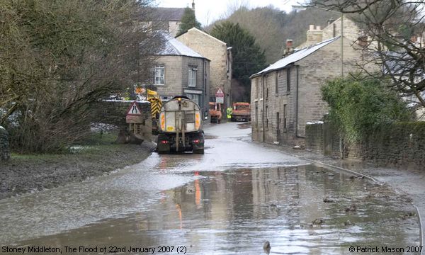
The Flood of 22nd January 2007, Stoney Middleton (2)
Disaster struck the lower lying areas in Stoney Middleton on the morning of 22nd January 2007. One of the dams belonging to the Glebe Mines further up the Dale broke its banks and a torrent of muddy water gushed down the roadway, sweeping away mud, stones, and rubbish - some of which can be seen in the foreground on this photo. In a more tranquil setting, there might have been ducks swimming on it! Just out of sight on this photo, beyond the house on the right, a side road leads down to the Church, and the area known as The Nook, and water streamed down there too. Luckily, the churchyard was spared, as the water took the course of the brook, but the houses beside and behind the Church were badly affected. This photograph was taken a few hours after the dam burst, but at its worst, the water reached about a third of a way up their walls. Diggers were brought in to help scoop up the worst of the mud and mess, and the road was closed between Calver and Wardlow Mires, but the cleanup continues... (Information provided by Rosemary Lockie)
Image contributed by Patrick Mason on 25th January 2007.
|
||
